Methodology:
Project Site: One Ann Arbor Neighborhood
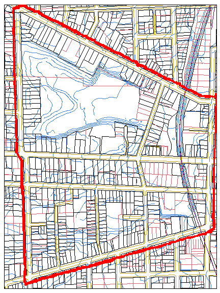
Outlined in red is the project area in Ann Arbor I have chosen to study. The neighborhood is bound by Miller Street on the north, First Street on the east, West Liberty Street on the south and South Seventh Street on the west and was chosen as the project site since it contains several diverse elements including historic features. Within the project site is a portion of the Old West Side neighborhood, an historic district; an open space feature, West Park; the subterranean Allen's Creek; as well as residential and commercial/industrial parcels.
Research:
The methodology for obtaining useful information for this research evolved through the semester. My professor, Sandra Arlinghaus, a number of local residents, several libraries, as well as several city offices were consulted. The Repositories Consulted and Outcomes describes in greater depth the various resources that were consulted.
After obtaining some historic photographs of the project site, photographs that duplicated the views in the historic images were taken for comparison purposes.
Throughout the semester, the GIS program, ArcView version 3.1, was explored to map the project site, to integrate other documentation about the landscape of the site and to analyze change over time.
Finally, this web site was developed over the course of the semester to display the findings, facilitate an analysis and to provide a media for presentation of the project.