The Relationship between
Bicycle Accidents and Lanes of Travel at Downtown Ann Arbor Intersections
Hyeyun Lee
Masters of Urban Planning Student
University of Michigan
Taubman College of Architecture
and Urban Planning
| The material in this article represents
an accumulation of material related to bicycle issues found within the
archives of the University of Michigan. In the summer of 2002, the
author will be an intern for the Environmental Coordinator of the City
of Ann Arbor, during which time she will have an opportunity to work the
current situation in a real-world setting.
The methodology involved the steps listed below, as well as others (see
http://www-personal.umich.edu/~hyeyunl for the full project):
-
View bicycle-accident map: specifies where bicycle accidents occurred.
Select the intersections to study. The number of accidents that occurred
from 1983 to 1992 were tabulated at each of those intersections (source:
John D. Nystuen for Ann Arbor Police Department data).
-
A brief survey was conducted at each intersection to calculate:
-
The number of lanes of traffic in each direction.
-
The angle of the intersection (at 6-way intersections, the angles were
averaged.)
|
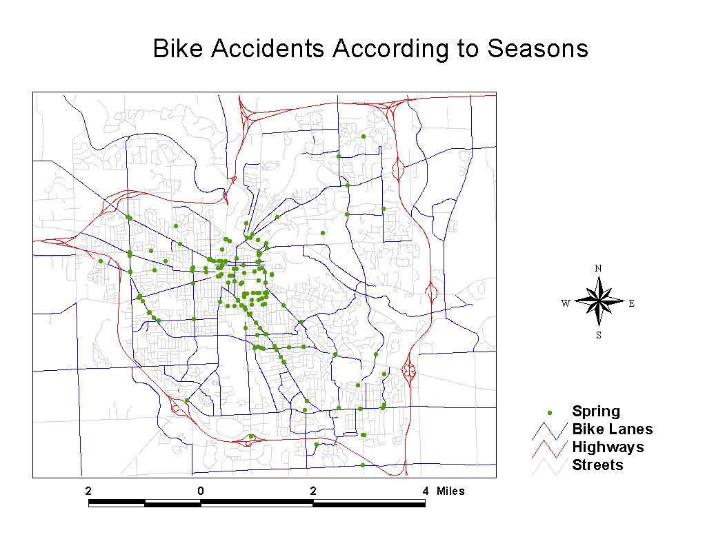
Animated map showing locations and numbers of bicycle accidents (scroll
over on low-resolution settings to see the entire map).
Click
here to see the interactive map.
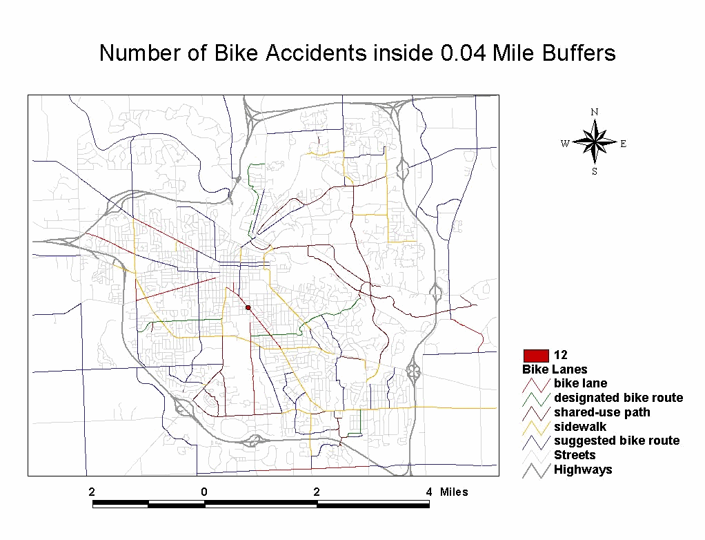
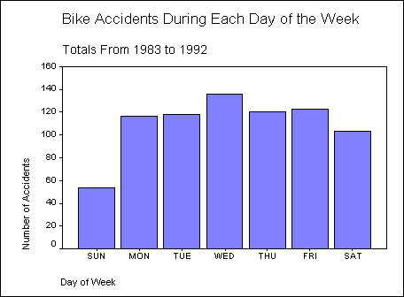
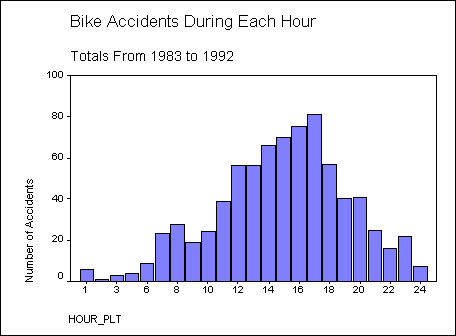
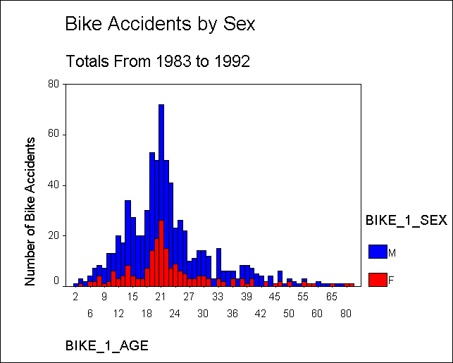
Bike Accidents
-
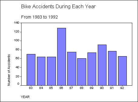
794 bike accidents happened in Ann Arbor from 1983 to 1992.
-
Buffers are around every intersection and the radius is 0.02 mile. (The
radius on the above map is 0.04 mile to show buffers better on the web.)
Bike Lanes (suggested by the Park and Recreational Department of City of
Ann Arbor, in June 2001).
-
Bike Lane: On-road travel lane designated for the exclusive use of bicycles.
-
Designated Bike Route: Road designated by green Bike Route sign, which
has either wide outside curb lane or low traffic volume.
-
Suggested Bike Route: Road which has either wide outside curb lane or low
traffic volume.
-
Shared-use Path: Off-road paved path for non-motorized use.
-
Sidewalk: Off-road facility bordering a roadway
|
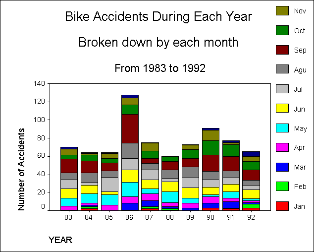
Animated map showing accidents by season (scroll over on low-resolution
settings to see the entire map).
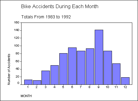
Spring(Mar, Apr, & May): 162
accidents, Summer(Jun, Jul, & Aug): 276 accidents, Fall(Sep,
Oct, & Nov): 282 accidents, and Winter(Dec, Jan, &
Feb): 43 accidents
| The information here serves as a baseline.
It is presented in animated and interactive formats to see change over
time. Current information will add to it and offer directions for
analysis that respond to contemporary needs. |