Concerns that involve the "static" and the "dynamic" elements of any issue are ones that endure, independent of discipline. De la Sierra, in looking at fragmentation patterns involving agricultural landuse on either side of the U.S./Mexico border, invokes principles from physics to breathe life back into static satellite photographs of his region of interest (Mapping Entropy, University of Michigan, School of Natural Resources and Environment, Ph.D. Dissertation, 1998). Indeed, there are many ways in which one can revitalize static images and return the dynamic component to them that once was there. Mathematical and scientific models offer one way to do so. Diffusion studies can offer an appealing way to do so when spatial change is measured over time, particularly when the pattern displayed is a simple one in which the eye can grasp changes as one jumps from one image to the next one in time. In the case of satellite photos of agricultural landuse patterns, however, the subtle patchwork quilt that fills the entire cathode ray tube does not lend itself well to being captured by the eye to its full extent. Thus, the eye may miss subtle changes that it would grasp in a scatter of dots when the same diffusion display techniques are used for changes in dot scatter and changes in landuse pattern.
Thus, we offer here a few visual techniques that offer promising ways of reducing the quilt-like landuse pattern to one that is easier to grasp, yet displays the desired information. In the publishing environment of the web, expansive use of color and animation offers opportunities for the display of spatial information previously undreamed of in the conventional publishing environment that traditionally balks even at a few color maps. In the sample below, we exploit various possibilities, beginning with a simple, single black and white Landsat photo.
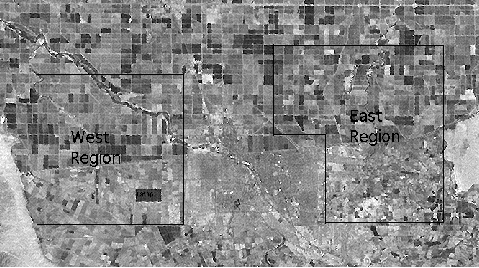
1. LandSat photo (click on this link) of the U.S./Mexico border region. De la Sierra partitions the region into urban and rural areas. The urban area is composed of Calexico on the U.S. side of the border, and Mexicali on the Mexico side of the border. The agricultural areas, he separates into U.S. East and U.S. West and Mexico East, Mexico Southeast, Mexico South, and Mexico West. The designations as to direction are in relation to the urban areas. The method of partition is based on a visual determination of pattern of landuse. Different grouping of parcels would result in different patterns and in different numerical measures (below). To suggest the role that the choice of partition might play, and the need for normalization, we include also values for arbitrary regions (with interpretation left to the reader).
2. Table of entropy values for each agricultural region in the
partition in the image above with non-arbitrary partition.
Mexico East: 1.86
Mexico Southeast: 1.39
Mexico South: 1.49
Mexico West: 1.72
U.S. West: 1.16
U.S. East: 0.73
Total Mexico: 1.73
Total U.S.: 1.02
For regions selected arbitrarily (but including land on both sides
of the border), the values were:
East: 1.76
West: 1.71
Combined total: 1.72
Generally, the measure is based on assessing the amount of disorder that appears in the pattern of agricultural landuse. The Mexico East region displays the greatest amount; the U.S. East region, the least. Readers interested in the detail of definition and calculation are referred to De la Sierra's document. For purposes of display techniques, it is sufficient for the reader to understand that this measure is a relative one, used to compare one region to another and to understand that higher values represent higher disorder in landuse pattern.
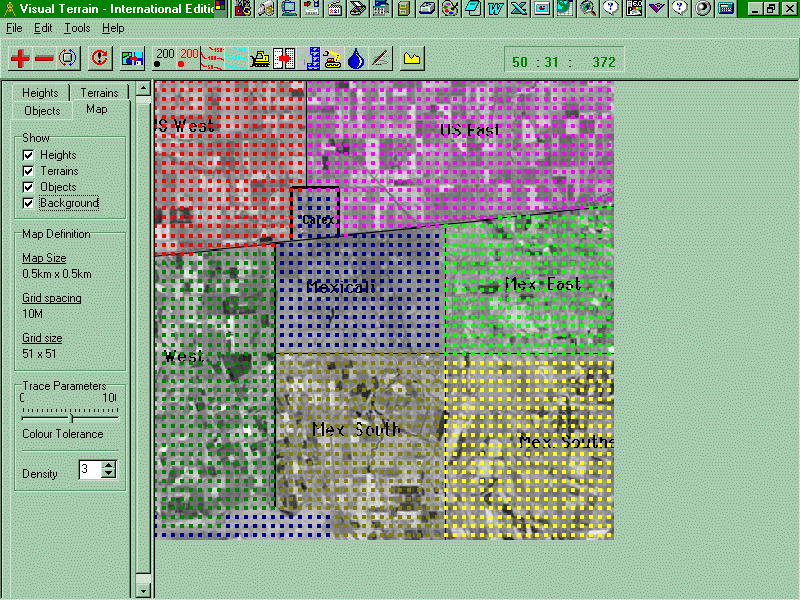
3. A square portion of the LandSat photo was saved, using Adobe PhotoShop 4.0.1 for Windows, as a .bmp file. This bitmap was then used as a backdrop in Visual Explorer 1.1 (WoolleySoft, Scotland) and entropy values from (2) above were entered as "elevation" values for each of the pixels in the six agricultural regions. Thus, a "topographic" map is created from the photographic backdrop in which the topography is determined by the entropy values. Pixels off the topographic surface (at the lower left and in the urbanized areas) were assigned values for "Total U.S." or "Total Mexico" (as appropriate). All values were multiplied by 200 to create a larger spread in the data.
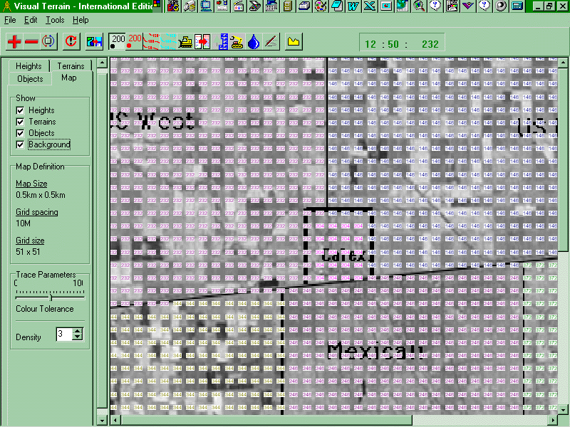
4. When one zooms in on the image in 3, eventually the "elevation" values replace the colored pixels, so that one may check the heights of each pixel to see that all is correct (see linked map).
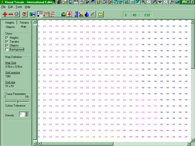
5. Further visual clarification is obtained by removing the backdrop and zooming in even more, to display the "elevations" to be assigned to each small location (see linked map). In the process, all connection with the original layout is lost but re-registers when put back.
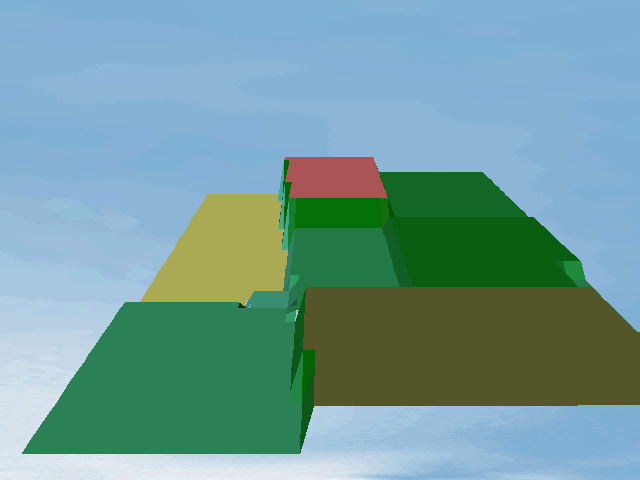
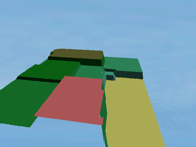
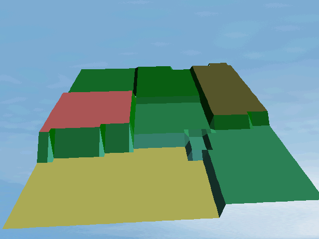
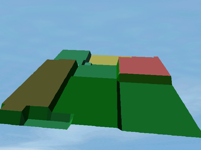
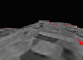
6. With this file of a two-dimensional photo that has been further loaded with elevations, it becomes possible to load this "digitized" file into Visual Animator where the 3-D view of the map comes to life. All of camera position, target position, vertical exaggeration, perspective, camera height, and camera angle have been held at the same setting for this sequence of four views. The international border runs along the cliff. The Mexican border regions show the highest degree of entropy. The U.S. regions exhibit the lowest values.
8. A flight through the view
above (in 7) appears in the animation below. The flight begins with
a view along the western border. The "plane" then moves over to the
U.S. Western region and flies eastward, across the red boundary separating
U.S. West from U.S. East. The border looms over the U.S. regions,
as cliffs over a channel. The gap through is at Calexico.