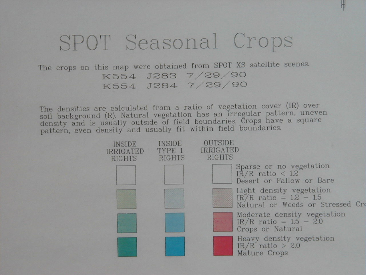
Using GIS to combine SPOT image with parcel map. USGS topographic sheet backdrop. The ribbon-shaped land use parcels at the upper and lower left corners are golf courses. Read the legend below for further detail.
Page 5.