Unit 174 American Contract Bridge League Bridge Clubs: Greater Houston
Bert Onstott
Secretary, ACBL Unit 174
3303 N. Sutton Sq.
Stafford, TX 77477
(H) 281-494-9644
(C) 713-851-1511
BertOnstott@ComCast.net
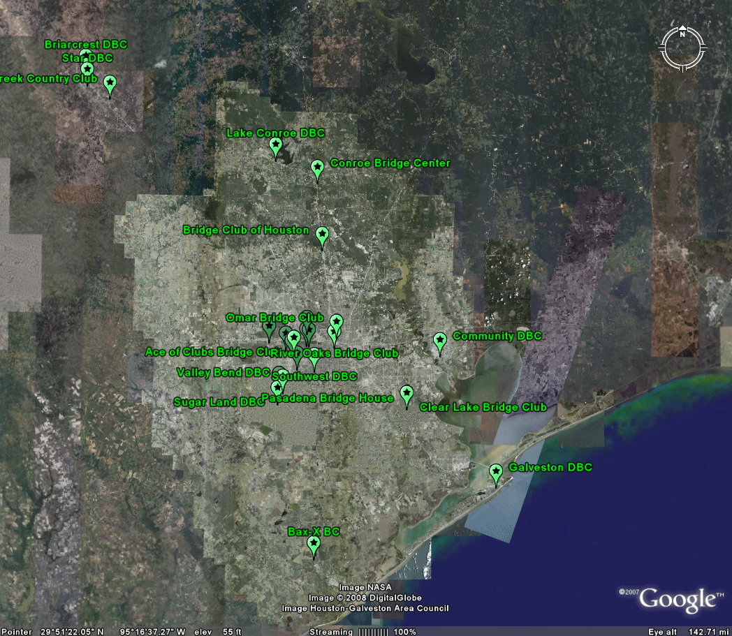
Large organizations with many members might find it particularly helpful to use Google Earth to visualize elements of their database. The animation below illustrates this idea for the location of duplicate bridge clubs in the Houston area: click on Galveston and information for the Galveston Duplicate Bridge Club pops up. Download the linked .kml file to see the file containing similar information for each marked club. Or, follow the link to the live url to see the linked kmz/kml file as it appears in Google Maps (imported there for the convenience of the non-technical reader not wishing to download Google Earth). Maintenance of a file such as this one is far easier than original creation of it. Thus, people looking for game times and contact information, as well as any special information, can find it at a glance for the whole area and make travel and game plans accordingly; they might also expect that the information will be current, given the relative ease of maintenance.
To view the .kml file, download the material from the zipped file that is archived in Deep Blue with a persistent url. The persistent url will continue to be available and will contain this explanation.
|
Link to live url:
http://www.d16acbl.org/U174/ |
Static screen shots (animated) from Google Earth:
 |
Solstice:
An Electronic Journal of Geography and Mathematics,
Volume
XIX, Number 1
Institute
of Mathematical Geography (IMaGe).
All
rights reserved worldwide, by IMaGe and by the authors.
Please
contact an appropriate party concerning citation of this article: sarhaus@umich.edu
http://www.imagenet.org