Detroit North American Bridge Championship: the Google Earth Display
Sandra Lach Arlinghaus
Adjunct Professor of Mathematical Geography and Population-Environment Dynamics, School of Natural Resources and Environment
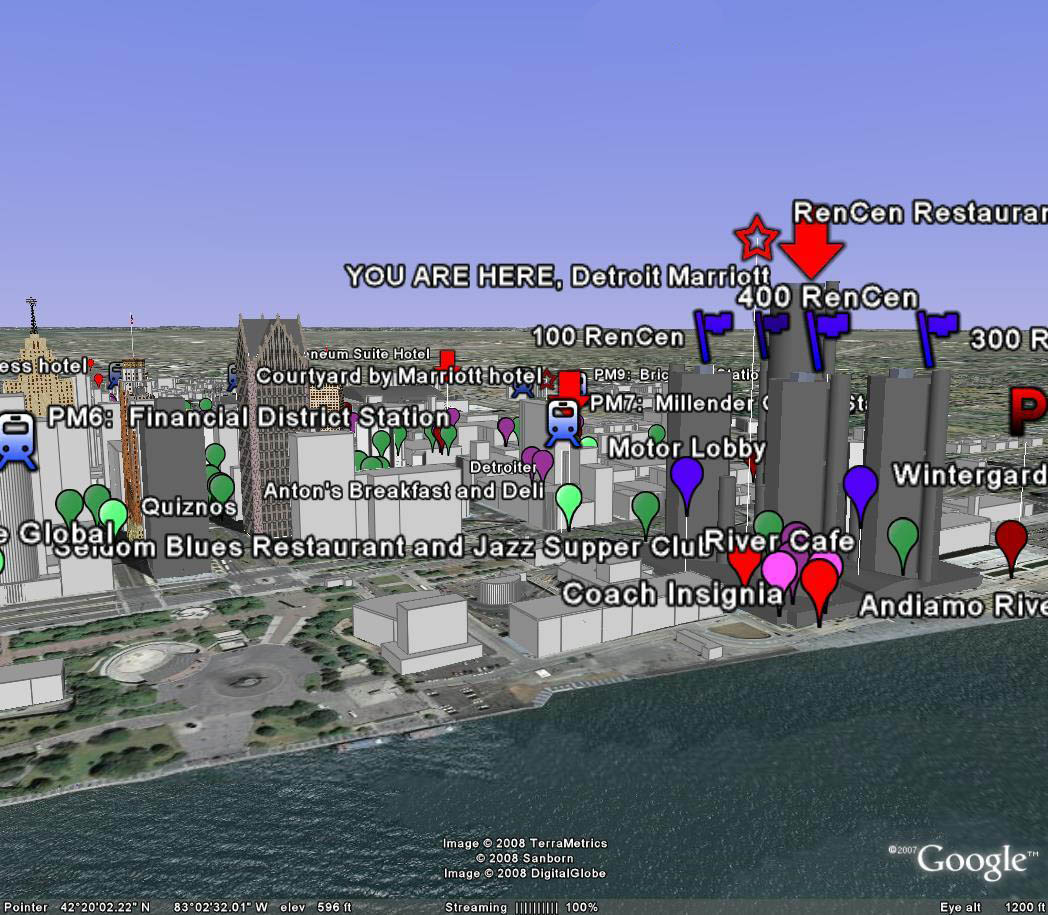
In March 2008, the author and two colleagues (William C. Arlinghaus and Ron Horwitz) served as co-chairs for the North American Bridge Championships held March 6-16 in the Detroit Marriott at the Renaissance Center. The event took over the entire 72 story hotel; effective communication was critical. One facet of an elaborate system was a laptop display projected on the wall. Google Earth captured some of the more complex arrangements concerning restaurant location and contact information. Marty Hirschman and his committee compiled and wrote the Restaurant Guide given in hard copy to all participants. Often, however, as at many conferences, participants did not always have handouts with them when they wanted them. Thus, competitors could come to a staffed desk, ask questions, and navigate through the streets of Detroit on a laptop to find where they might be going, first in the virtual world so that they were ready to proceed with adventure in the real world. The Google Earth display was a fine feature in support of other materials.
Unzip the associated files archived in Deep Blue to uncover the .kmz files and load them into Google Earth. Turn on the 3D Building switch in Google Earth to obtain a more realistic view of downtown Detroit.
Static screen shot from Google Earth:
 |
Solstice:
An Electronic Journal of Geography and Mathematics,
Volume
XIX, Number 1
Institute
of Mathematical Geography (IMaGe).
All
rights reserved worldwide, by IMaGe and by the authors.
Please
contact an appropriate party concerning citation of this article: sarhaus@umich.edu
http://www.imagenet.org