Huron River Tour, Ann Arbor
Matthew Naud
Environmental Coordinator and Assistant Emergency Manager, Systems Planning Unit, City of Ann Arbor
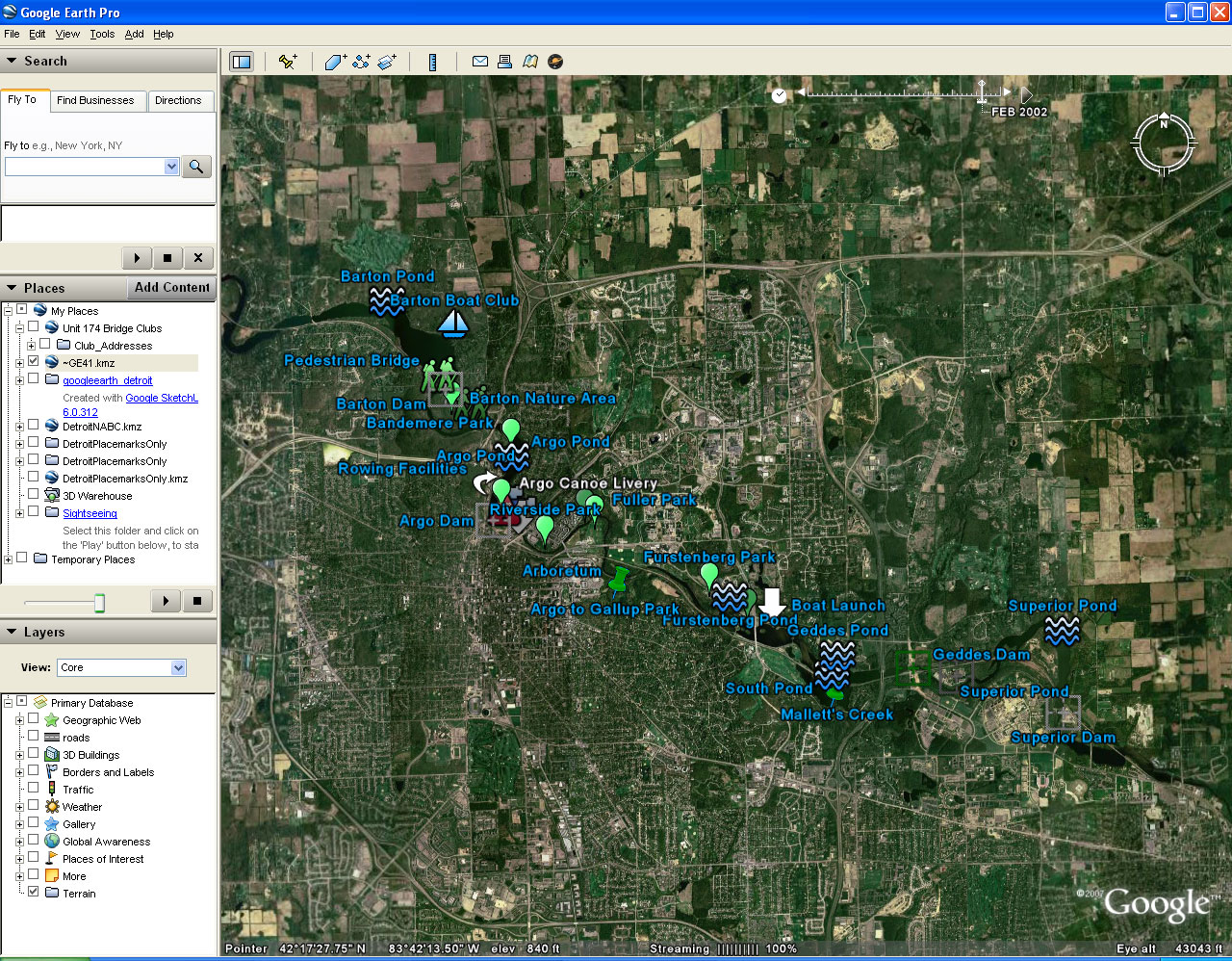
City planning for rivers is a challenge because these "wet" parks are waters of the state and not under direct control of the municipality. However, there are many services provided by the river to the residents of Ann Arbor - including drinking water, recreational spaces, and viewsheds - and without a long-term plan for the river with clear management strategies, invasive aquatics, sedimentation, and significant expenses will limit future recreational and other uses of the river.
The
Environmental Coordinator and Water Quality Manager for the City
of
Ann Arbor are lead staff on the Huron River and Impoundment
Management
Plan effort. Together, we are attempting to visually
demonstrate key
features of the river, the relationships among river stretches, the
primary users of the river and services provided by the river,
and the
many challenges to her sustainability. Google Earth
provides an
opportunity to cost effectively provide images at different scales -
the broad stretches on which the plan is based and the specific
locations of key users. We plan to develop a 15 minute
introductory
film for public meetings that creatively couples the Google Earth tour
with archival images, video footage from the Community Television
Network (CTN) and voice narration.
|
Link to live url:
http://www.a2gov.org/ |
Static screen shot from Google Earth:
 |
Solstice:
An Electronic Journal of Geography and Mathematics,
Volume
XIX, Number 1
Institute
of Mathematical Geography (IMaGe).
All
rights reserved worldwide, by IMaGe and by the authors.
Please
contact an appropriate party concerning citation of this article: sarhaus@umich.edu
http://www.imagenet.org