 |
The following virtual links offer a tour of the golf course "links." Study the photographic evidence (obtained by the author in the Fall of 2003; photographs retouched, where necessary, in Adobe Photoshop 7.0) of the course prior to play; get advice on each hole from the author, the City of Ann Arbor Men's Champion in 2002 and member of The University of Michigan golf team [Ed.]. Small photographs are linked to larger ones; click on the small photograph to link to a larger version of the same image.
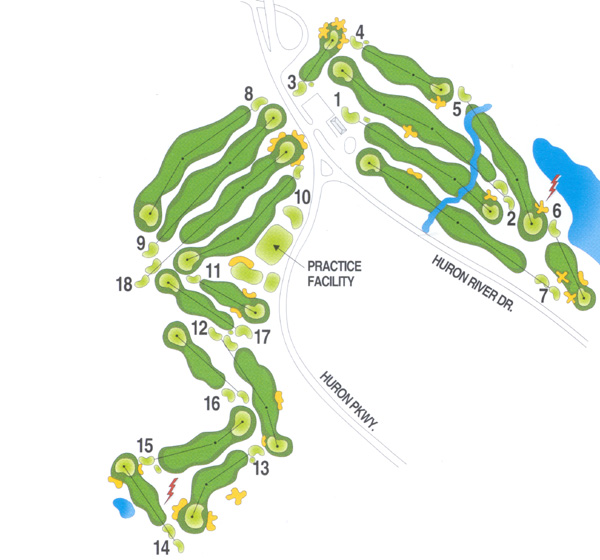
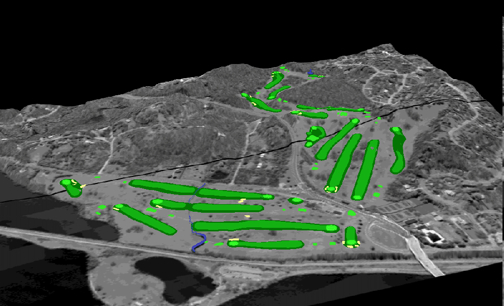
The map below, digitized by the author in ArcView GIS (version 3.2,
ESRI trademark) from City of Ann Arbor aerials and from field evidence,
shows the pattern and shape of elements of the golf course far more accurately
than does the cover on the linked scorecard.
Click on part of this map to begin your tour. It serves as a visual
table of content to the course. Click on individual holes for more
information.
|
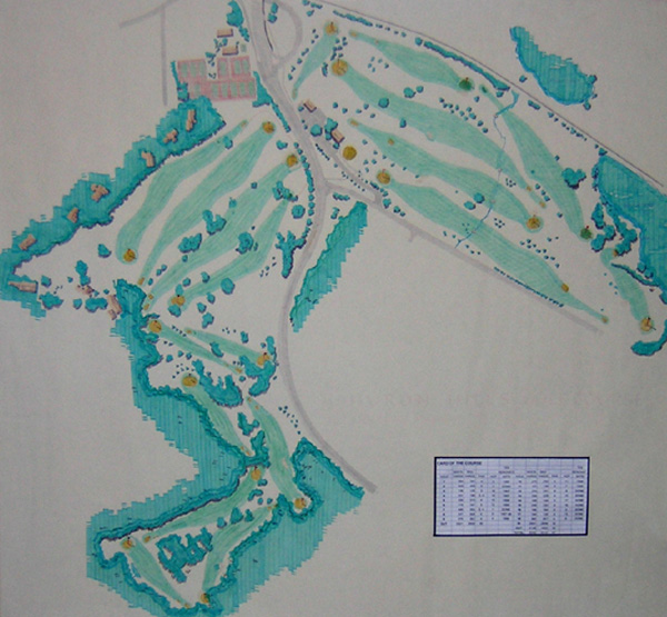
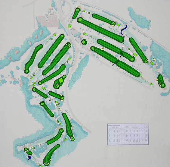
This linked image of the course has hung in the course clubhouse for many years. This image of Huron Hills is outdated and also has errors regarding course elements. A new wall-sized course map, derived from the clickable image above, now hangs in the clubhouse. One advantage to having a computerized image is that it is easy to change as the golf course changes. The old can be merged with the new, as in this link.
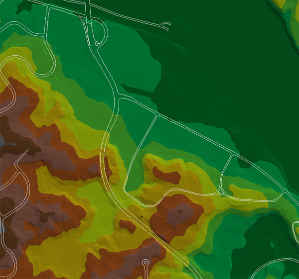
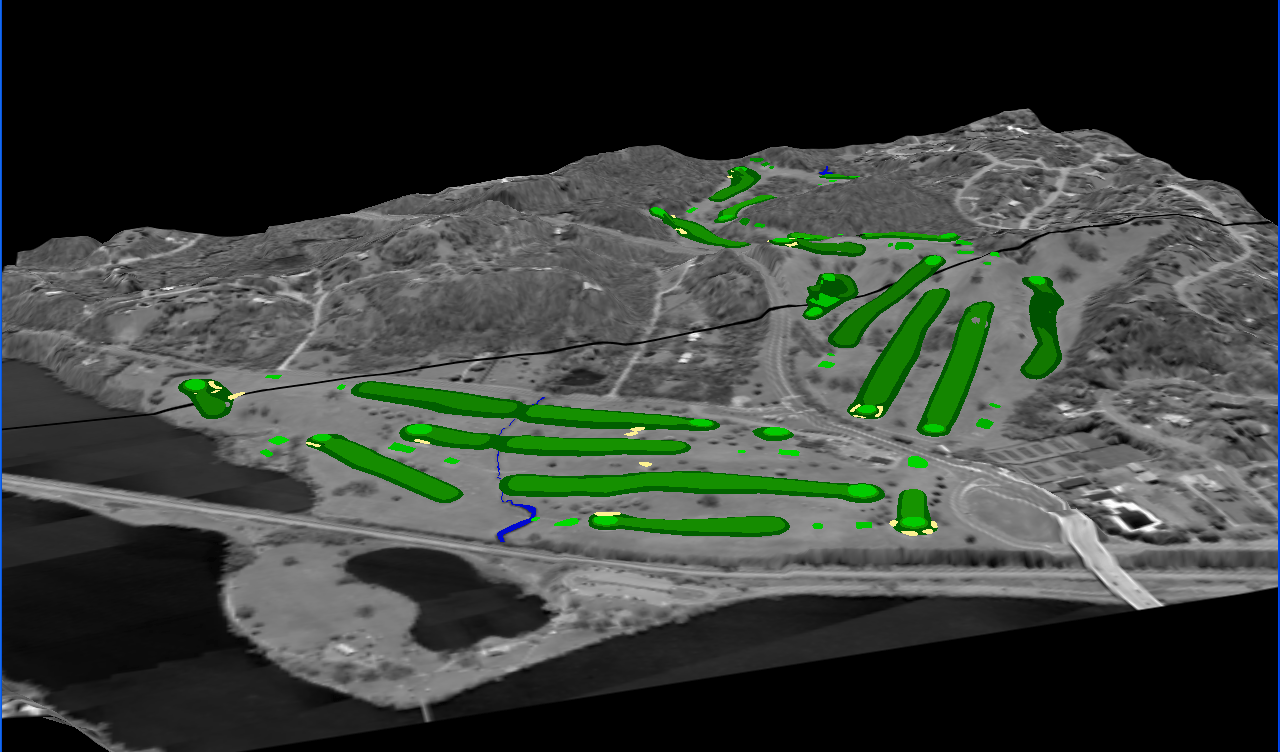
Much of the beauty and the challenge of this course comes from its rolling surface. This linked image, a Triangulated Irregular Network (TIN), represents the topographic surface on which the Huron Hills course sits (it was made using the City contour map as a base in ESRI software). The white lines in the image represent the roads in the area. The roads serve as a guide in placing the golf course within this picture. The contour of the golf course is undulating, especially the back nine, (the lower left corner). The change in color signifies a change in elevation of 15 feet.
Images that are TINs are useful as a base over which to drape other images. The next linked image was made by extruding the TIN in 3D Analyst Extension to ArcView GIS (ESRI trademark), draping the City aerial flown in 2002 over the TIN, and finally superimposing the GIS layers from the map above in order to show location of golf course holes in relation both to the topography and to the broader urban setting depicted in the aerial. The final link shows an animation of this draped image, from various vantage points (click the reload button to restart the animation). The golfer thus has a bird's eye view of the terrain as well as the capability to fly over it in a circle and study the lay of the land from various angles.
Software used: ESRI: ArcView GIS, v. 3.2, Spatial
Analyst Extension, and 3D Analyst Extension; Macromedia, Dreamweaver MX;
Adobe Photoshop 7.0 and ImageReady 7.0.
Acknowledgement: Thanks to Merle Johnson of the City of
Ann Arbor for supplying aerials and base maps of the region of this study.
Also to Colin Smith, Facility Supervisor of Huron
Hills Golf Course, City of Ann Arbor Parks and Recreation Department.
Editor's note: Mr. Walton will be leaving for Scotland,
to study for an advanced degree in golf
course architecture: an MSc, School of Landscape Architecture,
Edinburgh School of Art, Heriot-Watt University, Edinburgh, Scotland.
Look for golf courses designed by Andrew Walton, in the future!