|
SET IN STONE:
An Analemma in Northern Italy.
John D. Nystuen
The University of Michigan
and
Community Systems Foundation
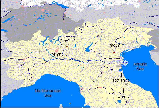
On a recent trip through
the less traveled parts of northern Italy (less traveled compared to the
crowds encountered in Rome, Florence, and Venice) our traveling party found
expected, and surprising, evidence of the great contributions to our modern
world made by Italians in the first and second millennia. The evidence
is set in stone.
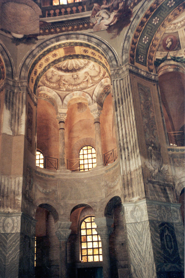
In the fifth and sixth centuries
A.D. Ravenna, on the Adriatic Sea, was the seat
of authority of the emergent church at the time the division was opening
between the eastern and western churches. Evidence of both Byzantine
and western Christian traditions are preserved in the beautiful mosaics
of the churches, mausoleums, and other religious places in Ravenna.
The images, made of stone and colorful glass, have remained bright and
clear over time. The interior of Basilica
di Santo Vitale (6th century) is an example. Many mosaics
in the basilica cover walls, ceilings, and floors as do others in various
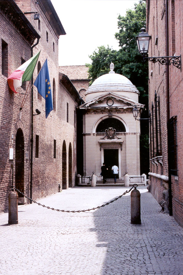
religious structures throughout the city. Ravenna has been continuously
occupied; it was an intellectual center during the Renaissance. Dantes
tomb next to the old churches is evidence of the importance of the
city in the thirteenth and fourteenth centuries (Dante 1265-1321).
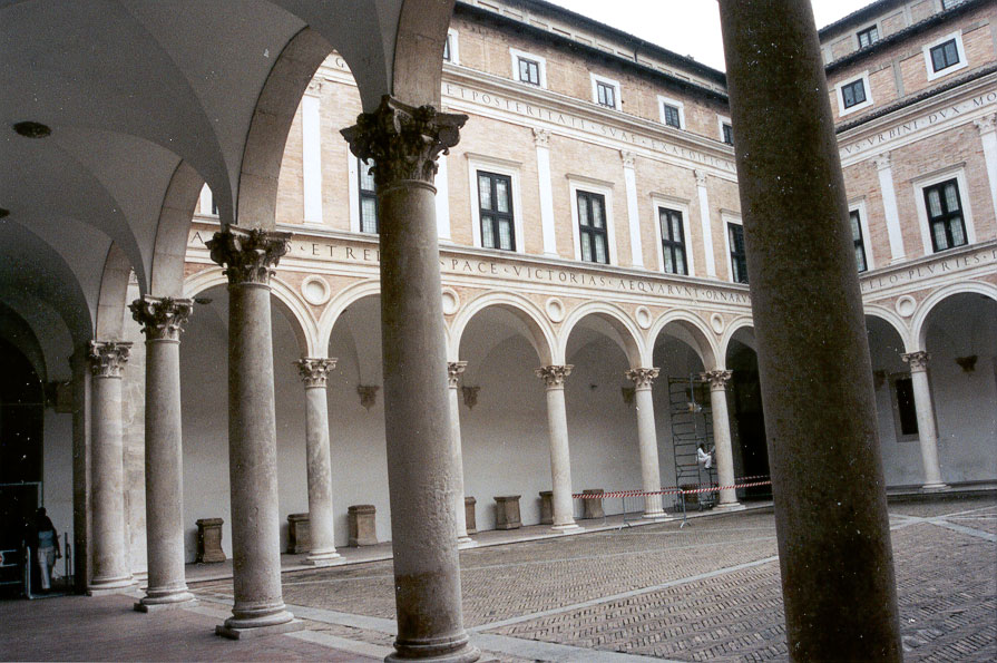
Urbino
is a well-preserved Renaissance town in the mountains to the south of Ravenna.
It was prominent in Italian history for two short centuries after which
fortunes declined and it was annexed to the Papal States in 1631 and left
to languish in obscurity. Its rise to fame was due to Duke Federico
di Montefeltro (1444-1482) who was most influential in advancing its political,
artistic, and intellectual achievements. The value of this history to us
is that the magnificent Ducal Palace (the linked
photo shows its courtyard) and other renaissance buildings in the city
were not demolished or scavenged in the process of building new structures
suited to subsequent eras. In the decline, the Palace fell into a
state of abandonment and many of its art treasures were scattered to Rome,
Florence and other seats of power. Restoration began in the early
part of the 20th century and the Palace is now the National Gallery of
the Marche. Also, fortunately, the Palace appears to have escaped
the ravages of World War II despite the fact that heavy fighting occurred
in the vicinity. Urbino was by-passed by the battles of that conflict.
Restoration of the Ducal
Palace, along with the new acquisition of Renaissance art, has created
a magnificent museum of the Renaissance. Here, within limestone
and marble walls more delicate evidence of high civilization can be seen
in the paintings, sculptures, and inlaid wooden cabinets and doors.
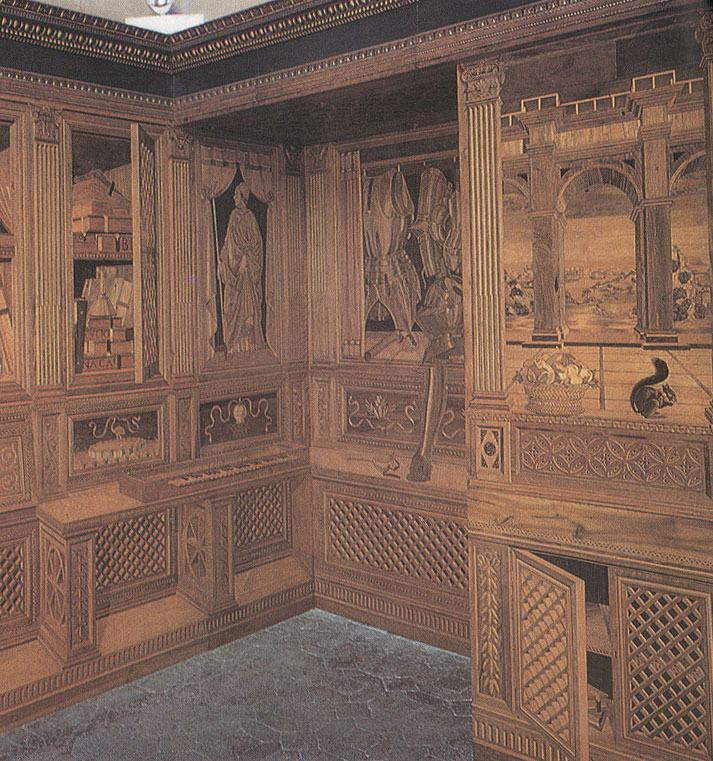
The Duke's study, paneled with inlaid wood,
celebrates the discovery of perspective views used by artists to depict,
with mathematical precision, three dimensional images on two dimensional
surfaces. The panels in the Duke's study have several versions of
the illusion of three dimensions executed on a flat surface.
Padua
is another mid-sized Italian city just to the north of Ravenna with architecture
and art dating back before the renaissance. It is also the site of
some of Galileo's experiments with telescopes and of the first scientific
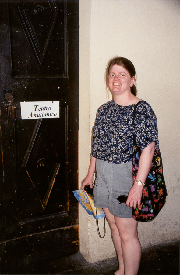
studies of the human body carried out by careful dissection of cadavers.
These medical demonstrations took place on the stage of a steep-sided amphitheater
located at the University of Padua, one of the oldest universities in Europe,
founded in 1222 (Leslie Nystuen, M.D. attempts
to enter the amphitheater). The careful, dispassionate demonstrations
by professors in front of medical students were meant to impart knowledge
to medical students as it was being created through use of the new empirical
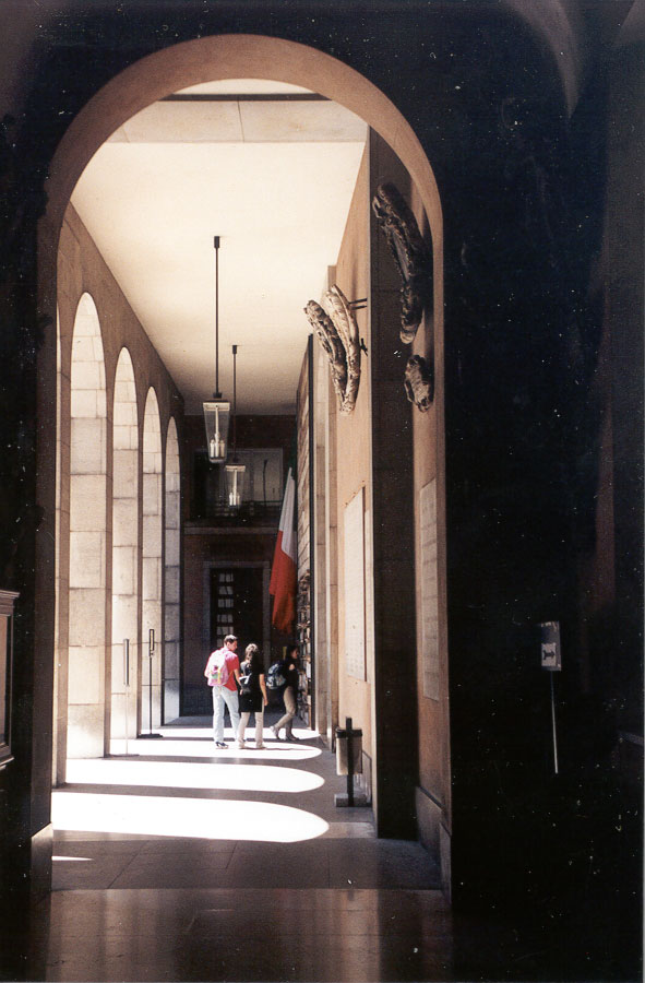
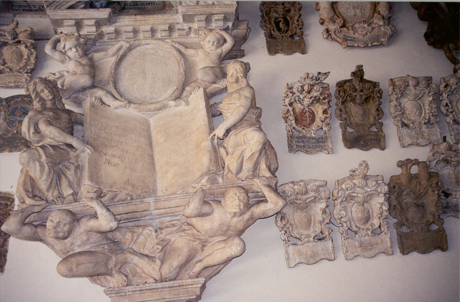
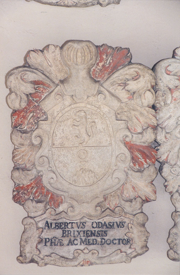
tradition of science. The walls of the loggia
enclosing
the old courtyard of the Bo Palace, one of the core buildings of the university,
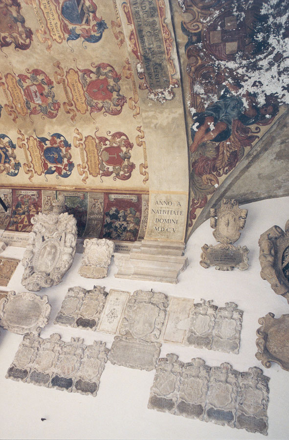
are lined with stone
seals and crests of graduates of the
medical school.
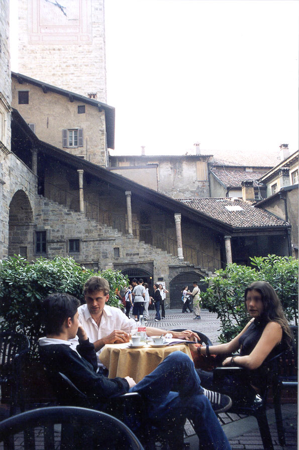
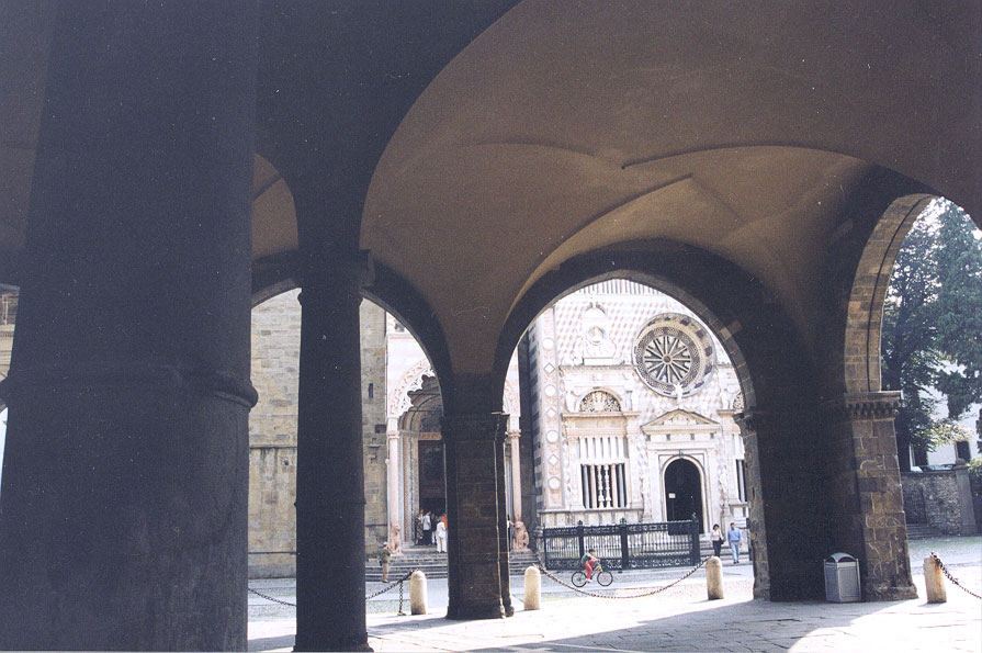
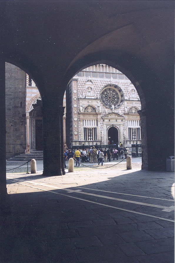
Bergamo
is a city located at the foot of the Alps northeast of Milan. The
city is divided into the old, Alti Calli (high city) located high up steep-sloped
hills with the new town spread out across more level surfaces at lower
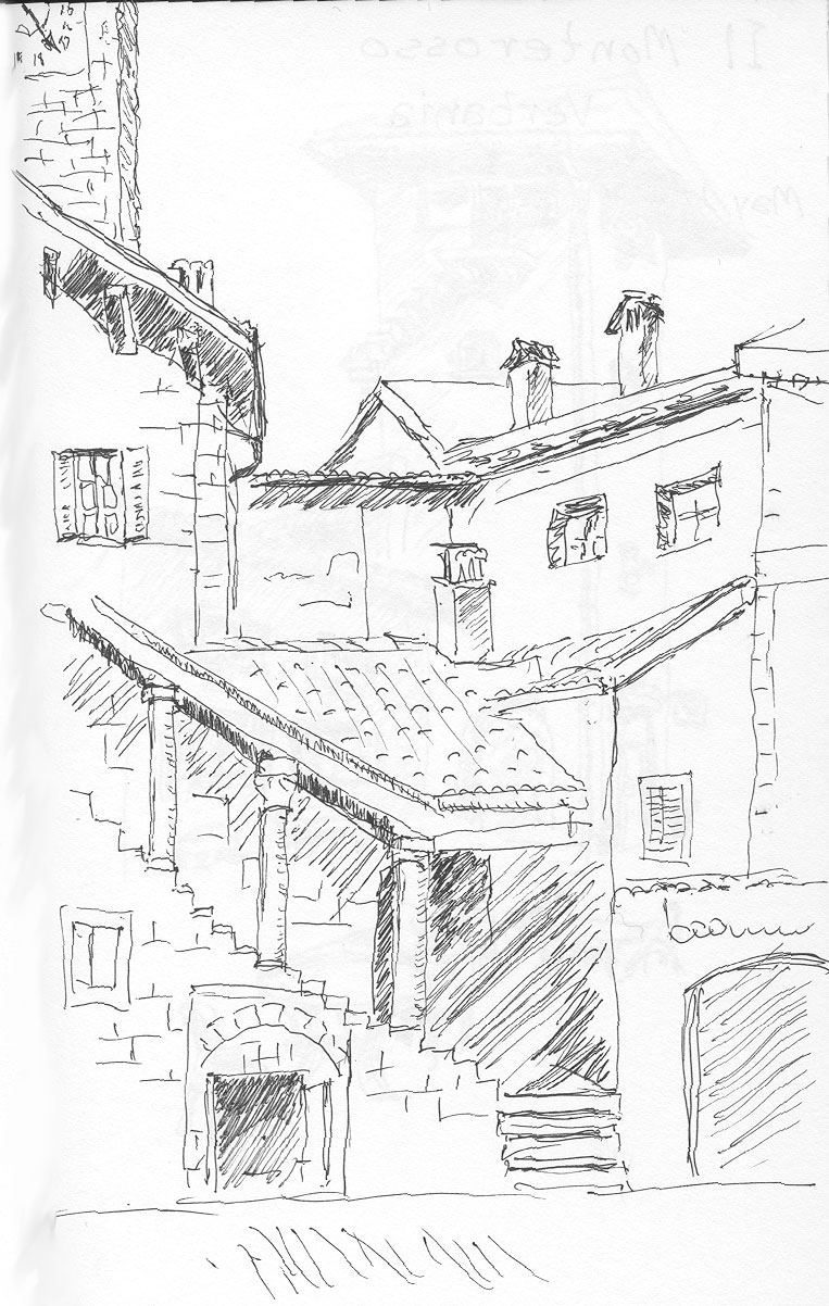
elevations. The central piazza might serve as a setting for a Shakespearean
play (photo; sketch
by author). A medieval cathedral and a renaissance church stand
close together at one end of the main piazza and are separated from it
by an open-sided arcade covered by a high arched
and vaulted ceiling.
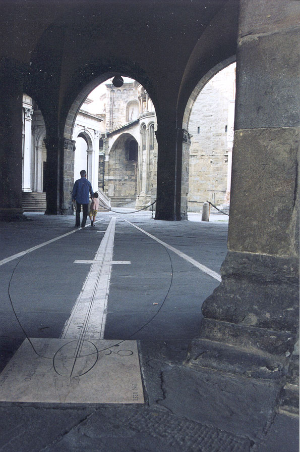
An unusual feature located under this covered
space is an analemma (and meridian) made of marble
inlaid in the stone floor. An analemma is a graduated plot of the
declination of the sun observed at solar noon throughout the year.
A beam of sunlight passes through a small hole in a shield mounted
high on the south facing wall. Through the course of a year the beam
traces out the equation of time in an elongated, asymmetric
figure 8 . The months and days of the year are marked on the
analemma and each day is illuminated in turn by the sunbeam as it traces
out a calendar year. The centerline of the structure marks the line of
the meridian (north/south direction). At solar noon on the day of
the Winter Solstice (December 20 or 21) the sun is at its lowest declination
and casts its pencil of sunlight onto the crossing of the meridian by the
analemma trace at the extreme northern extent of the larger of the loops
of the figure 8 shape. On the summer solstice (June 20 or 21) the
sun is at its highest
point in the sky and the pencil of sunlight illuminates the crossing
of the analemma trace with the meridian on the southern extreme of the
smaller of the loops of the figure 8. The light beam crosses the
meridian twice more during the year; in the center of the figure 8, once
on the Spring Equinox and again on the Fall Equinox but with the pencil
of light approaching from opposite directions.
On our visit, we immediately recognized the
inlaid figure on the floor to be an analemma but we were puzzled because
it was located under a roof and surrounded by large buildings. How
could direct sunlight fall on it? Close observation revealed that
to the south just enough open sky existed to permit the sun
to shine through the shield and onto the floor at noon on any day of
the year (with a view of the shield in mind, now check back to the broader
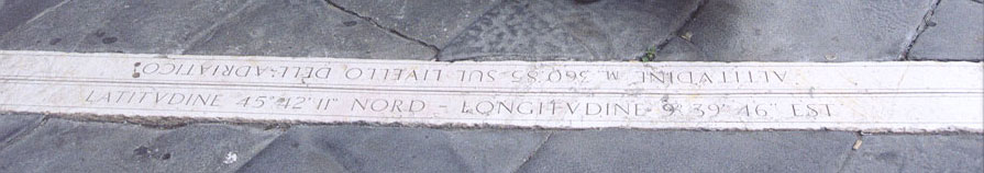
general picture to see it in context). Analemmas are specific
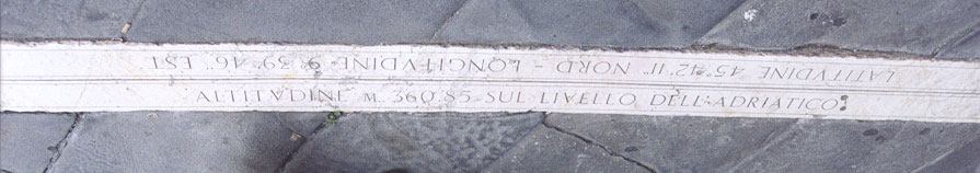
to the latitude at which they are located. Inscribed in the floor
along with the analemma is a record of the latitude, longitude and elevation
of the figure. The inscription reads, <Latitude
45° 12 11 Nord, - Longitude 9° 39 46 Est> and on another
line, <Altitudine M 360.85 sul livello Dell Adriatico>
.
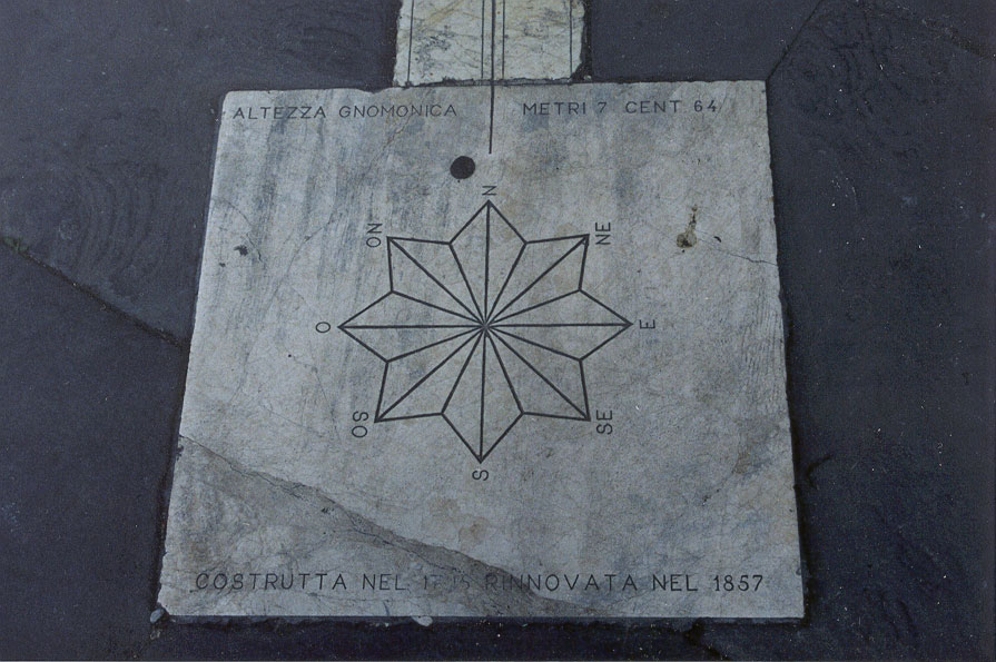
A compass rose is
also present to which is affixed the presumed date of the work, 1857.
That date is 137 years after telescope-equipped theodolites came into wide
use for accurate measurement of angles (1720) (Wilford, p. 97). In
that era, more accurate and stable surveying equipment was introduced and
used for land surveys and earth measurements. In 1666, Isaac Newton
had predicted that the earth might be better modeled as an ellipsoid or
oblate spheroid (a solid figure generated by rotating an ellipse around
its short, or minor, axis) than as a sphere (Wilford p.99). Using
the improved surveying instruments and techniques, the French investigated
this hypothesis by undertaking to measure an arc of the earth near the
North Pole along the Meridian of Kitts (Lapland) (1736-37) and similarly
along the Meridian of Quito (Ecuador) (1735-43) (Wilford, p. 101).
The arc nearer the pole proved flatter than the arc at the equator, that
is, a degree at high latitudes is longer than a degree near the equator.
The curvature of the earth is greater at the equator and flatter near the
poles. The technology increasing the precision in the measurement
of angles and distances had been put to great scientific purpose, establishing
the shape of the earth by empirical means in support of theory.
That more precise earth model was needed for
the Bergamo analemma to be constructed with sufficient precision of shape
and position for the sunbeam to stay on the track laid in stone.
The Italians had undertaken cadastral and topographic surveys of northern
Italy by the time the Bergamo analemma was constructed. Knowledge
from such surveys would have been used to fix the location and altitude
of the analemma. The two decimal figures for altitude implied high
order geodetic control.
I wonder though whether theory alone was sufficient
to predict the placement of the analemma relative to the shield mounted
on the wall. It could be closely predicted but I speculate that the
theory might have been backed up by empirical observations made throughout
the seasons. Theory would direct how the construction should proceed;
practice, on sunny days throughout the year, would suggest the location
of the beam of light that could then be checked and recorded empirically.
This presumes that they could determine the moment that high noon occurred.
Over the months the precise path of the spot of light could be traced out.
Our overnight (May 15) visit to Bergamo was
too short for us to learn of the history of the construction. A large
library located on the piazza no doubt has a record of the project and
perhaps on another day we will return and look into it. We were able
to conduct some empirical observations of our own. Jeffrey
Nystuen, one of our party, had a portable GPS (global positioning system)
receiver. The instrument was a hand held Magellan GPS receiver that
he named Enrico, after Henry the Navigator (1394-1460). Despite being
under cover with little open sky visible, Enrico
could fix the location and altitude of the analemma. The receiver
recorded the same latitude to the exact second as that written in the stone.
There was one-second difference in longitude. Enrico reported elevation
as five meters higher than that recorded in stone. Fixing elevation
with a GPS is less exact than fixing position.
The length of one second of longitude at 45
degrees north can be approximated by multiplying the cosine of latitude
by the length of a second of longitude at the equator of the authalic sphere
(a sphere with the same surface area of the ellipsoidal model of the earth)
(Robinson, et al.). This works out to be about 22 meters .
Using the GPS Precise Positioning Service the positioning error of the
Magellan GPS receiver should be less than 2 meters. [The
circumference of the authalic sphere is 40,030.2 kilometers; thus, dividing
the circumference by 360 yields one degree as equal to 111.195 kilometers
and, subdividing further, one second as 30.89 meters. Cosine 45 degrees
times 30.89 meters equals approximately 22 meters (Robinson, et al.).]
In May of 2000, the Selective
Availability feature of the GPS was turned off by the U.S. government.
Prior to this date, for military purposes, deliberate degrading of the
stability of the on-board atomic clocks in the GPS satellites degraded
the GPS signals. The Standard Positioning Service that had been previously
available (worldwide) provided at best 100 meter accuracy. As it
was, this degradation could by overcome by using differential GPS procedures
in which a base receiver station with a well-known position could be used
in conjunction with a roving receiver. This procedure was being routinely
applied by a variety of civilian users.
Today relatively inexpensive GPS receivers
are being employed in myriad tasks not at all envisioned by the designers
of the system. For example Enrico, the hand-held receiver, provides
the basic latitude, longitude, and altitude with error terms attached but
it can also indicate direction and speed of movement -- even walking speed.
One can fix a position in Enrico's memory, such as the location of the
parked car, and then wander off through a maze of medieval Italian streets
and Enrico can show the path to take to return to the car. It has
in its memory the locations of most towns and cities with population greater
than twenty thousand, at least, in North America and Europe where Enrico
has been put to use.
Precise agreement in latitude and one second
discrepancy in longitude seems very good for the performance of a hand-held
GPS receiver and for the older methods that were employed to locate and
design the analemma. Yet given the assumed accuracies, a 22 meter
discrepancy may be too large. The likely explanation is in the differences
in the theories applied. The Italians in 1858 modeled the earth as
an ellipsoid using the best available datum (values for earth radii and
eccentricity) perhaps the Bessel, 1841 model that is widely used in Europe.
This datum differs from WGS84 (World Geodetic System, 1984) which now is
used in conjunction with modeling the satellite orbits. Those orbits
respond to the earth's center of gravity, not its geometric center.
The same basic assumption must be made to achieve identical results.
What the good correspondence we observed indicates is that both models
are very good.
The Italians have made many contributions
to Western Civilization and to our modern global society. Fortunately
records of some of these achievements have been set in stone. I wonder,
in this new informational age that we live in today and that is so rapidly
becoming digital and electronic, are we leaving imprinted forms so durable
that after one hundred fifty years, a thousand years, or fifteen hundred
years they will be fresh and bright, full of grace and beauty and intellectual
achievement? Will they charm passing travelers?
References
-
Alfred Leick, 1990 GPS Satellite Surveying. New York: John Wiley
& Sons, Inc.
-
John Noble Wilford, 1981 The Mapmakers, New York: Alfred A. Knopf,
Inc. 1981.
-
Arthur H. Robinson, Joel L. Morrison, Philip C. Muercke, A. Jon Kimerling,
Stephen C. Guptill, 1995 Elements of Cartography, sixth edition.
New York: John Wiley & Sons, Inc.
|
|