OCTOBER 6, 2007
Sandra Lach Arlinghaus, Ph.D.
|
"Future Work Extend Ann Arbor, as a pilot project, elsewhere in the world particularly where CSF has interests." PROGRESS REPORT Extension of Ann Arbor Google Earth model to the entire city:
More complex broader projects:
Learning how to help others... Extending projects and the prospect of self-reliance Matt Naud, City of Ann Arbor Environmental Coordinator
University Resource: 3D Laboratory, Duderstadt Center. Klaus-Peter Beier, Director; Lars Schumann, Manager. Link to the Virtual Reality Laboratory 3D Atlas of Ann Arbor, 3rd Edition: cover image See http://www.imagenet.org/ Praise from Google: Link to file of selected e-mail commentary. Link to materials from the "Google Picks" category of the 3D Warehouse Featured Modeler: Archimedes Cities in Development Help Model a City For the future: continue to develop imaginative uses of Google Earth and work with Oswalt to integrate these, as possible, into the general DevInfo framework. Work immediately prior to last year's presentation: 3D Atlas of Ann Arbor, 1st Edition. 3D Atlas of Ann Arbor, Flood file sample. 3D Atlas of Ann Arbor, Google Earth Approach: Part I; Part II Buildings and floods... Earlier
work
Previous
work, coupled using kiosks to move from one scale to another.
Look at the "Archive," too. Note links on buildings and on kiosks
within the associated vrml files. There are links throughout to
work
done by students in previous years and to work done by various
professional
colleagues.
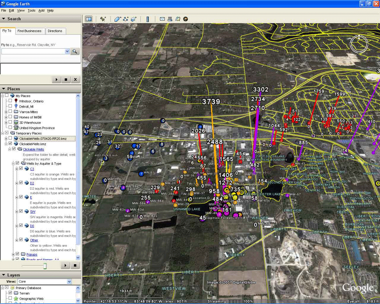
Clickable
maps display large amounts of information quickly and easily.
Virtual London: similar strategies employed in London and in Ann Arbor. Web presentation from City Hall on flooding concerns. Minutes from a Downtown Residential Taskforce meeting. |
Copyright, S. Arlinghaus, 2007.